Mt. Fuji Observation Deck
Main content starts here.
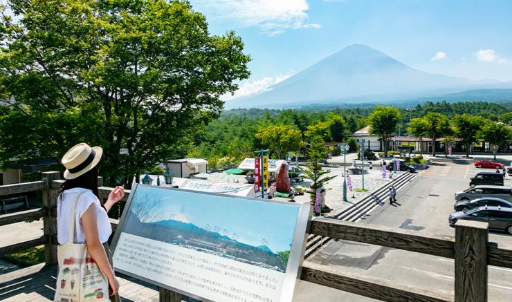
Viewing Mount Fuji on its own is splendid enough, but it is in relation to the surrounding mountains that one can begin to comprehend the sheer scale and size of Japan’s most iconic mountain. The enormous basaltic stratovolcano is flanked by smaller volcanoes such as Mt. Tenjin, Mt. Nagao, and Mt. Katabuta, and towers above them all.
The formation of Mt. Fuji began approximately 500,000 years ago with volcanic eruptions in an area 7 kilometers north of where the mountain is today. These eruptions eventually formed a volcano called pre-Komitake in the same location. Mt. Fuji’s distinctive cone shape was formed across 100,000 to 200,000 years of volcanic activity, transforming the “old” Fuji on the south side of pre-Komitake into the behemoth that is present-day Mt. Fuji.
In the year 864, the northeastern side of Mt. Fuji erupted for 10 consecutive days, spewing cinders and ash as far away as Tokyo Bay. The ensuing lava flows turned the surrounding area into a sea of fire, filling a lake at the foot of the mountain with lava and dividing it into two smaller lakes. The lava base eventually became the Aokigahara Forest, covering an area of approximately 30 square kilometers.
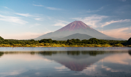
Not visible from this deck but no less interesting is Mt. Omuro. Located at the northwestern foot of Mt. Fuji and south of the Aokigahara Forest, it is one of the many secondary volcanoes of Mt. Fuji. Mt. Omuro can be viewed from Lake Shoji and faintly resembles Mt. Fuji in miniature, earning it the nickname kodaki-Fuji (“Fuji Cradling a Child”). The mountain’s crater is 500 meters in diameter and is 22 meters deep at its summit.
Category
Share
Venue Address
Narusawa, Narusawa-mura, Minamitsuru-gun
-
Nature & Outdoors
-
Nature & Outdoors
-
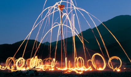
Events & Festivals
Home of Mt. Fuji > Uncover > Mt. Fuji Observation Deck
YAMANASHI Home To Mt. Fuji