


HOME > HILLCLIMB > Introduction of hill-climbing courses > Mt. Fuji Hill Climb
Main content starts here.

Mt. Fuji Hill Climb
This hill climb course is the grandest of its kind in Japan in various aspects, including having the highest finish line and having the largest number of race participants in a single day. It starts at the Kenritsu Fuji Hokuroku Parking Lot, and the finish line is Mt. Fuji 5th Station. The completion rate of the “Yamanashi, Country of Mt. Fuji, Mt. Fuji Hill Climb,” a race held in June each year, is 99%, and 6,000 people participate, aiming to receive a gold finisher ring (bicycle part called a “column spacer”), which is given to runners who reach the finish line in 1 hour and 5 minutes or less. The course features a broad road width and gradual slope so it relatively easy for beginners to try. This area has strikingly beautiful views of Mt. Fuji. The surrounding landscape gradually begins to change around 3rd Station, and it is possible to look out at surrounding mountains such as the Minami Alps and take in expansive views of beautiful natural settings.

![]()
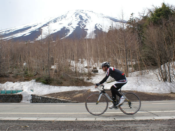
Running on World Heritage Site Mt. Fuji feels great. The surrounding scenery is impressive.

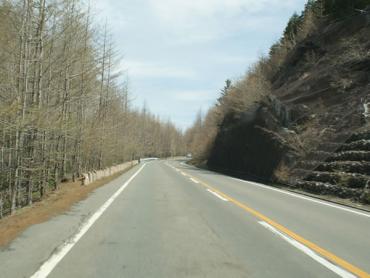
There is a long distance to 1st Station, and there are many places with steep gradients. If you use up your energy here, you will be worn out on the second half of the course, so it is best to reserve some energy on the way to 1st Station.
Beyond 3rd Station the slope gets gentler so it becomes easier to increase your speed. There are a number of spots with steep gradients of above 7%, but overall this is a course with many gently sloped sections.
If you use up too much energy on in the steep areas, it will be difficult to increase your speed at the gently sloped areas, so keep this in mind as you set your pace.
Course guide
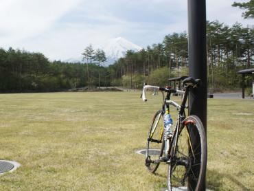
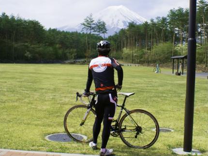
The starting point is Kenritsu Fuji-Hokuroku Parking Lot. There is a great view of Mt. Fuji here.
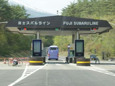
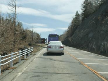
The measurement starting point is the Subaru Line Toll Gate. The round-trip toll is 200 yen per bicycle.
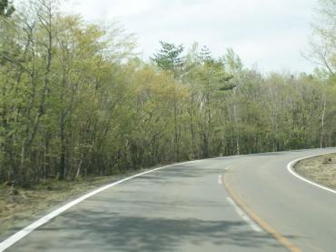
There is a long distance to 1st Station and the road is sloped. There is still a long way to go before you reach the finish line, so it is best to go at moderate pace and avoid overstraining yourself.
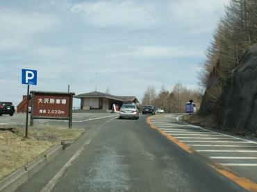
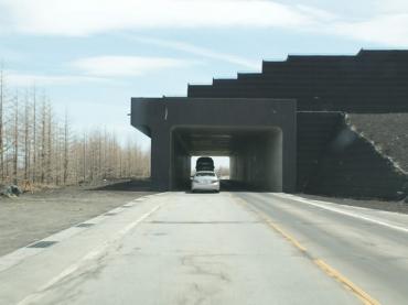
Beyond Osawa Parking Lot, there are expansive views. The landscape changes at this point, and the Minami Alps come into view.
The gradient becomes gentler here, so this is a good place to try to improve your time.
From the sign for the "Okuniwa Natural Park Entrance," there is a more or less straight line to the finish line.
Just ahead of the finish line, there is a towering, 200-m long steep slope. You are almost at the finish line, and this is the last stretch!
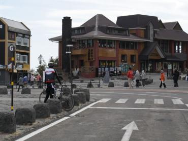
The finish line is 5th Station. The "G" point on the left side of the pedestrian crossing is the measurement finishing point.
Video of course
Course information
| Difficulty level |
|
Elevation difference | 1,270m |
| Travel distance | 25km | Gradient | Average of 5.2%, maximum of 7.8% |
Access
| Start | Kenritsu Fuji-Hokuroku Parking Lot |
| Finish | Mt. Fuji 5th Station |
| Access by car | From Tokyo[When using the Chuo Expressway]Chuo Expressway Hachioji Interchange -> Chuo Expressway Kawaguchiko Interchange, from here drive of about 5 minutes[When using the Tomei Expressway]Tomei Expressway Tokyo Interchange -> Gotemba Interchange -> local road -> Higashifuji-goko Road Subashiri Interchange -> Fujiyoshida Interchange, visible from hereFrom NagoyaTomei Expressway Nagoya Interchange -> Gotemba Interchange -> local road -> Higashifuji-goko Road Subashiri Interchange -> Fujiyoshida Interchange, visible from hereFrom ShizuokaTomei Expressway Fuji Interchange or Shin-Tomei Expressway Shin-Fuji Interchange -> National Route 139, from here drive of about 1 hour and 30 minutes |
| Access by train | Transfer at JR Chuo Main Line Otsuki Station, then drop off at Fujikyuko Line Fujisan Station, from here bicycle ride of about 25 minutes on local road |
Route map
近隣のスポットを探す
Click the below icons to display the facilities on the map.
![]()
![]()