


HOME > HILLCLIMB > Introduction of hill-climbing courses > Odarumitoge Pass Hill Climb
Main content starts here.

Odarumitoge Pass Hill Climb
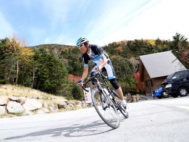
The Odarumitoge Pass Hill Climb is a 30-km course that finishes at Odarumitoge Pass, Japan’s highest peak that has a roadway. After passing by Otomeko Lake and through winding roads in a forest, it is possible to see the peak of Mt. Kinpu (elevation 2,599 m), which is connected to Odarumitoge Pass. If the weather is good, it also possible to see Mt. Fuji. Once you pass through a bamboo forest on a flat road, you will start to see alpine plants, and then spectacular and wondrous views. Near the finish line, you will encounter a path that is so steep and beautiful that former professional cyclist Daisuke Imanaka says it is on par with Col du Galibier, which is known as an hors cat?gorie" section of the Tour de France.

![]()
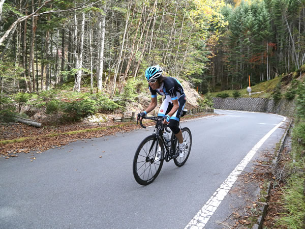
At close to 2,000 m, this course has one of the top elevation differences in Japan. Daisuke Imanaka comments, “In terms of level, this course is on par with the mountain passes that professionals ride over in Europe and so on. It is not an easy climb, so should not be undertaken lightly. You might want to take on this challenge once a year, or even once in your lifetime.”

Start with low gears
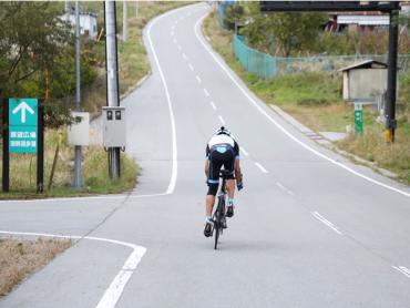
A steep slope begins at the starting point and continues until the middle of course, so set your bike to a low gear and get ready for a challenge. Signs on the side of the road show the distance to the finish line at the peak, so these can help you set your pace. Once you pass Otomeko Lake, another steep slope begins with a gradient of around 15%. Try not to use too much physical strength. It is possible to easily maintain your momentum by pushing down on the pedals using your body weight with the right timing (standing pedaling). It is best to use your lower body in a rhythmical manner and keep your body axis centered.
Increase your speed at the gently sloped section
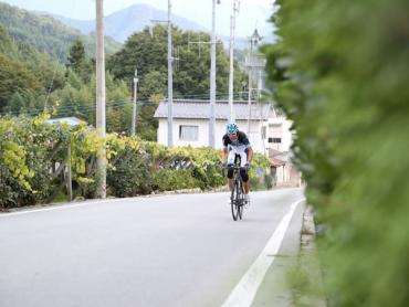
After traveling on a winding road through the forest, the stretch of 12 km to 8 km from the finish line will be relatively gently sloped, and then the last part of the course is steep. If you are hoping to improve your time, it is best to increase your speed on the gently sloped section. Also, it is best to always train yourself to increase your speed in a calm and efficient manner when the ride starts to get difficult.
Make thorough preparations
This is a very tough course with a large elevation gain. In order to keep the necessary gear to a minimum, you should plan to depart in the morning and start back down in the afternoon when the temperature is warm. There is a significant temperature difference between starting point and finish line, so to keep your body warm, you should bring not only a windbreaker, but also arm covers and leg warmers, etc. Cycling this course will burn 2,000 to 3,000 calories, so it is essential to take drinks and food. Take plenty of time to rest at the finish line, and then descend slowly in a relaxed manner.
Course guide
Departure from Kubodaira Intersection. Following the signs for “Crystal Line,” bear left at this Y-shaped intersection and then turn right.
Go straight ahead and you will pass Yamanashi City Fuegawa Junior High School and Makioka Daiichi Elementary School on your right. Cross over Karisaka Road (Route 140), and a straight steep slope will start with expansive grape fields on both sides. At the top of this slope, there is the last vending machine for the rest of the course.
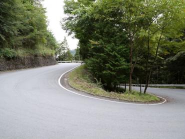
The straight section will end and you will enter a forest. There will be a series of ridges with a mix of straight and winding sections.
Proceed upward along Kotogawa River. Once you get higher and your field of vision has increased, there will be large Japanese horse chestnut trees on the right. Otomeko Lake will soon come into view.
You will see Otomeko Lake, which is the location Kotogawa Dam, to the left. This is a good spot for a taking a break. If you do not break here, it is best to try to go nonstop down the hill toward the lake and then up the steep slope.
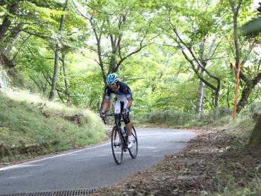
There will once again be a series of winding ridges. If you are looking to improve your time, try to adeptly increase your speed on the gently sloped section that starts after around 10 km from the finish line. If competing with other cyclists, you will find that maintaining an aerodynamic form makes a difference in terms of your speed.
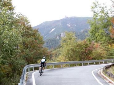
Your field of vision will become unobstructed ahead and the peak of Mt. Kinpu will come into view. As the elevation increases, the surrounding landscape will change and it will be possible to see alpine plants, boulders, and large trees, etc.
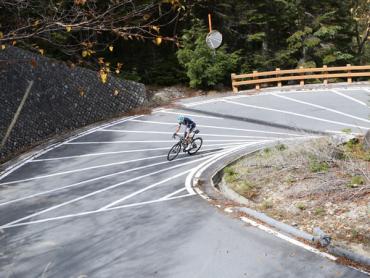
There will be several hairpin curves, and then you will enter the last section, with 3 km left before the finish line.
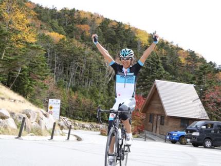
The peak of Odarumitoge Pass, where Odarumi-goya Hut is located, is the finish line. There is an exceptional feeling of accomplishment when arriving at Japan’s highest peak that has a roadway!
*Please note that the road from Otomeko Lake to Odarumitoge Pass closes during the winter.
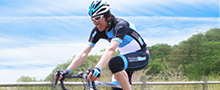
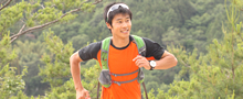
Supervisor/model: Daisuke Imanaka, Former Professional Road-racing Cyclist; Representative, InterMax
Video of course
Course information
| Difficulty level |
|
Elevation difference | 1,886m |
| Travel distance | 29.5km | Gradient | Average of 6.4%, maximum of 15% |
Access
| Start | Kubodaira Intersection |
| Finish | Odarumi-goya Hut |
| Access by car |
From Tokyo Chuo Expressway Hachioji Interchange -> Chuo Expressway Katsunuma Interchange, from here drive of 15 minutes From Nagoya Tomei Expressway Nagoya Interchange -> Chuo Expressway Komaki Junction -> Chuo Expressway Katsunuma Interchange, from here drive of 15 minutes |
| Access by train | JR Chuo Main Line Enzan Station, from here bicycle ride of about 20 minutes |
Route map
近隣のスポットを探す
Click the below icons to display the facilities on the map.
![]()
![]()