


HOME > HILLCLIMB > Introduction of hill-climbing courses > Mt. Mizugaki Hill Climb
Main content starts here.

Mt. Mizugaki Hill Climb
The Mt. Mizugaki Hill Climb is a beautiful course where it is possible to enjoy greenery during the spring and summer and fiery-colored foliage during the autumn and winter. The course is long, but is interesting because there is a lot of variation, which includes proceeding from a plain national road to a gentle slope up to Mizugakiko Lake, and then to a steep slope for the second half of the course. There are two possible routes at Mizugakiko Lake: one straight ahead on the Masutomi Radium Line and one crossing over a large bridge. As such, this course can be enjoyed in different ways depending on the route taken and the season.

![]()
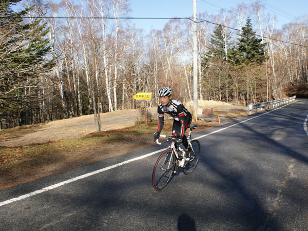
Mt. Mizugaki, which has an elevation of 2,230 m, overlooks the course. There is an elevation difference of more than 1,000 m between the starting point and the finish line, which is the Mt. Mizugaki Trailhead. As such, various changes of landscape can be seen along the way.

From the starting point, there is a long gradual slope up to Mizugakiko Lake. The course has a long distance, so during the first half it is best to ride at a reasonable pace and save your strength. In the areas with private residences, be careful of pedestrians and vehicles coming out onto the main street from narrow side roads. If you are trying to improve your time, it is best to try to increase your speed on the extended level sections between slopes.
Course guide
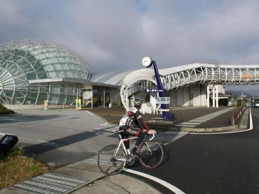
Depart from Roadside Station Nirasaki. There is a long flat stretch on the national road, and this is ideal for warming up. There is a lot of traffic on this road, so please be careful of this while riding.
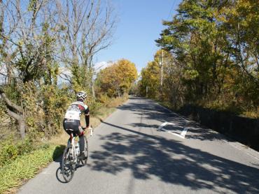
On the way to Masutomi Radium Line, there is a flat section and a downhill section, so please be careful not to go too fast. There is then a gradual slope up to Mizugakiko Lake. There is still a long distance to travel, so it is best to ride here at a moderate pace and enjoy the surrounding scenery.
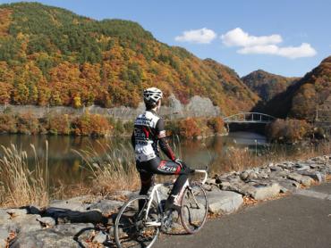
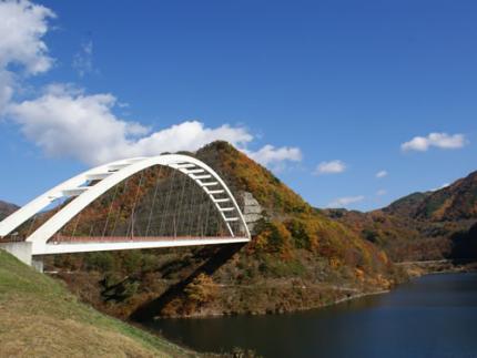
Upon arriving at Mizugakiko Lake, turn right at the fork. The steep slopes start on the other side of the tunnel. It is also possible to take a different route to the finish line by turning left at Mizugakiko Lake.
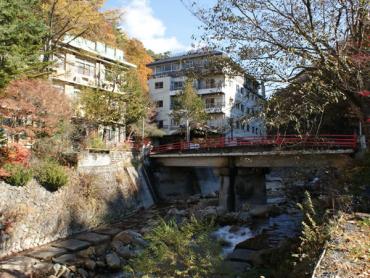
You will pass through the Masutomi Radium Onsenkyo Hot Spring Village, a hot spring town with a nice atmosphere. Beyond this town there is a forest with a refreshing feeling.
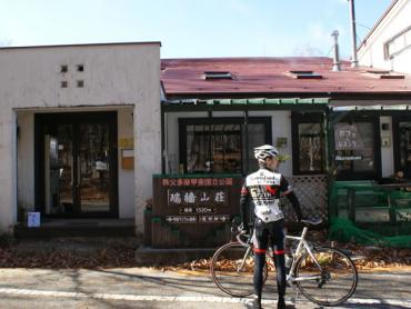
After traveling through the forest along a small river, you will arrive at Mizugaki-sanso Hut.
Alternate route, turning left at Mizugakiko Lake
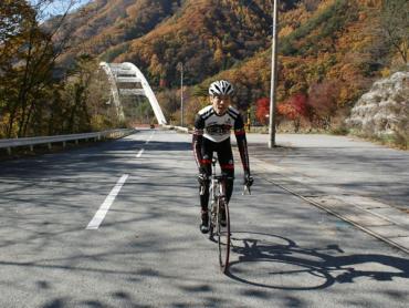
Turn left at Mizugakiko Lake and cross over the large bridge. After crossing this bridge, a steep slope with a gradient of 10% continues for about 1 km. This is followed by an expansive tranquil rural landscape, and as you approach the finish line, you will be able to see the precipitous peak of Mt. Mizugaki.
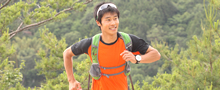
Supervisor/model: Yuki Watanabe, Team Representative, Forzik Yamanashi
Video of course
Course information
| Difficulty level |
|
Elevation difference | 1,111m |
| Travel distance | 28km | Gradient | Average of 3.9%, maximum of 12% |
Access
| Start | Roadside Station Nirasaki |
| Finish | Mizugaki-sanso Hut |
| Access by car |
From Tokyo Chuo Expressway Hachioji Interchange -> Chuo Expressway Nirasaki Interchange, from here drive of about 10 minutes From Nagoya Tomei Expressway Nagoya Interchange -> Chuo Expressway Komaki Junction -> Chuo Expressway Nirasaki Interchange, from here drive of about 10 minutes |
| Access by train | JR Chuo Main Line Shinpu Station, from here bicycle ride of about 10 minutes |
Route map
近隣のスポットを探す
Click the below icons to display the facilities on the map.
![]()
![]()