


HOME > MARATHON > Introducing marathon courses > Minami Alps Togenkyo Marathon
Main content starts here.

Minami Alps Togenkyo Marathon
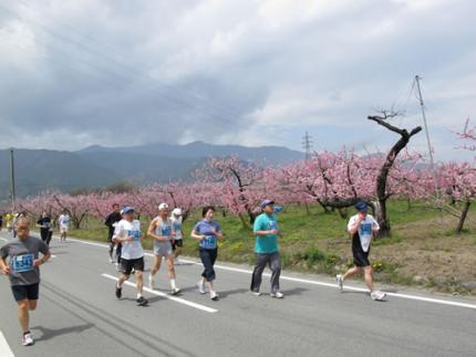
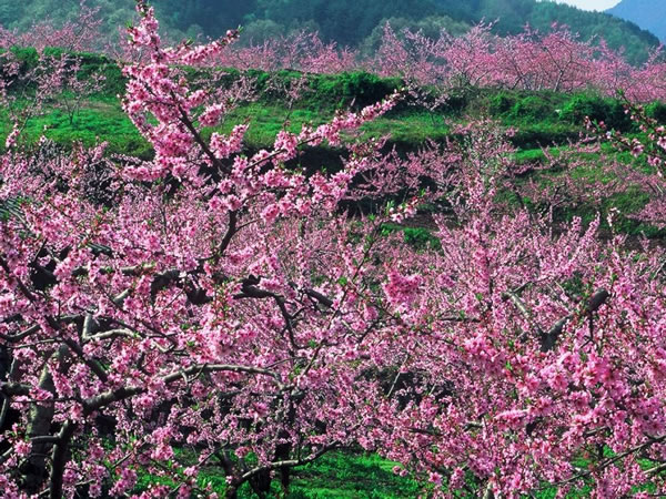
The Minami Alps Togenkyo Marathon is a half marathon course that cuts across Minami-Alps City from north to south. While running on this course, it is possible to see distant mountain scenery and beautiful landscapes of peach and plum blossoms in the spring. One attractive feature of this course is the fact that there is a pleasant elevation difference of 168 m.

![]()
From early to mid April the peach trees here are in full bloom. Just as the name “Togenkyo (Shangri-La)” implies, this is a run with amazing scenery.

There is an ascent of about 5 km from the starting point, and it is best to run this without going too fast and conserving energy.
Course guide
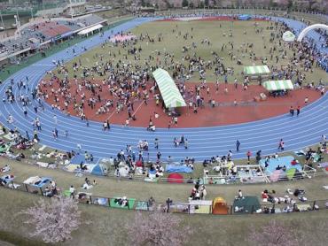
Start at Minami-Alps City Kushigata Park. (Photo shows course during race.)
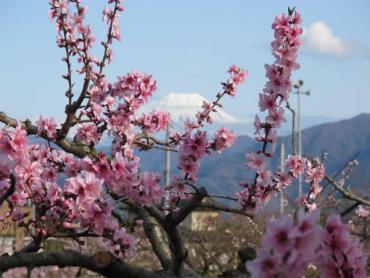
The course runs along a road colored with peach blossoms. It turns back after reaching the Togen Fruit Line.
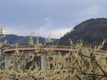
The course passes close by the Shirane Toka-bashi Bridge (Loop Bridge). When the peach and plum trees are in bloom, this spot becomes a Shangri-La.
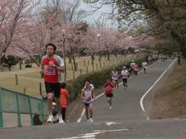
The course turns back at Ochiai Elementary School, and turns north toward the finish line. As such, this course covers a long distance from north to south. (Photo shows course during race.)
Course information
| Difficulty level | Elevation difference | 168m | |
| Travel distance | 21.0975 km(half marathon) | Gradient |
Access
| Start | Minami-Alps City Kushigata Park |
| Finish | Minami-Alps City Kushigata Park |
| Access by car |
From Tokyo Chuo Expressway Hachioji Interchange -> Chuo Expressway Futaba Junction -> Chubu-Odan Expressway Minami Alps Interchange, from here drive of 10 minutes From Nagoya Nagoya Expressway Nagoya Interchange -> Chuo Expressway Komaki Junction -> Chuo Expressway Futaba Junction -> Chubu-Odan Expressway Minami Alps Interchange, from here drive of 10 minutes |
| Access by train | JR Chuo Main Line Kofu Station -> bus to "Ogasawara-bashi" bus stop, from here walk of 20 minutes |
Route map
近隣のスポットを探す
Click the below icons to display the facilities on the map.
![]()
![]()