


HOME > TRAILRUNNING > Introduction of trailrunning Courses > Mt. Hinata Trail Run
Main content starts here.

Mt. Hinata Trail Run
This course traverses Mt. Hinata, which has an elevation of 1,659 m and lies on the ridge between Mt. Kaikoma and Mt. Nokogiri. One attractive feature of this course is its great mountain peak view. After passing through a green mountain tree grove, a white world of weathered granite blooms before you. On the ascending part of the course, there is only one descent along the way, and the other section repeatedly switches between ascents and flat areas, so the run up to the peak does not get dull. At the peak, the course returns down the same path as the ascent, and the total distance is 4 km.
*The route down to Nishiki-taki Waterfall from the peak collapsed in one area, so is closed. (as of September 2013)

![]()
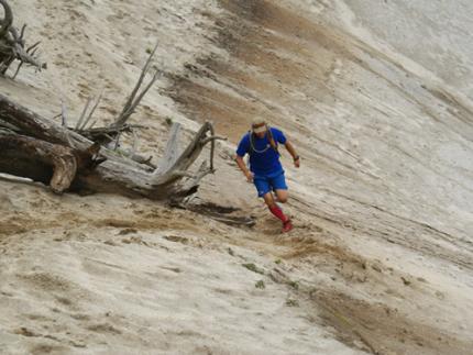
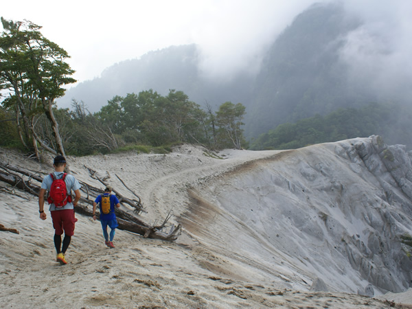
Kenichi Yamamoto (trail runner), who frequently trains at Mt. Hinata, comments on the snow-like white peak, saying, “This is sandy soil, so it is a mysterious sight.”

The distance to the peak is 2 km so this course is easy for beginners to try. Also, there are signs that divide the elevation of course into 10 equal parts, so it easy for runners to set a pace. This is also a hiking course so it is bustling with hikers on the weekends. Stay safe while running, give the hikers the right of way, and take care not to bump into them.
Course guide
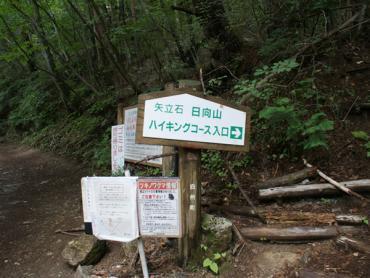
Start at the Yadateishi Trailhead, which is marked by a sign for the entrance of the hiking course.
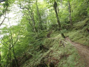
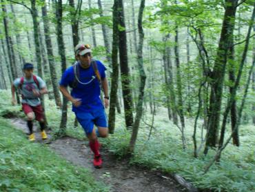
The course proceeds through a forest of Japanese larch.
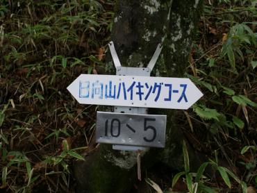
There are signs along the way, dividing the elevation of the course into 10 equal parts.
As you get closer to the peak, the air will get clearer and a tree grove will come into view.
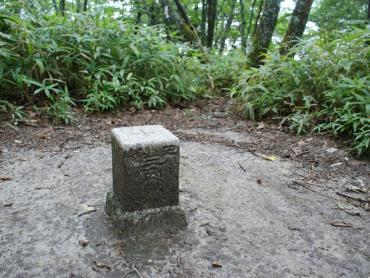
At the end of a small branch off the path, there is a third-order triangulation point. The peak is just a little bit farther.
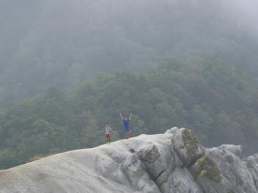
When you arrive at the peak of Mt. Hinata, a snow-like white mysterious sight will bloom before you. The Yatsugatake Mountains can also be seen ahead.
After a break, head back down the mountain. It is easy to go too fast when descending, so run with caution, especially where there are curves with poor visibility.
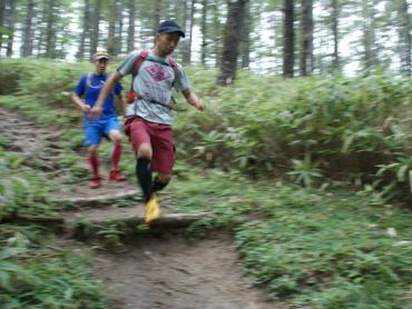
Models: Mitsuhiro Ishikura and Masato Shirasawa
Course information
| Difficulty level |
|
Elevation difference | 540m |
| Travel distance | 4km | Gradient |
Access
| Start | Yadateishi Trailhead |
| Finish | Yadateishi Trailhead |
| Access by car | From TokyoChuo Expressway Hachioji Interchange -> Chuo Expressway Sutama Interchange, from here drive of about 60 minutesFrom NagoyaTomei Expressway Nagoya Interchange -> Chuo Expressway Komaki Junction -> Chuo Expressway Sutama Interchange, from here drive of about 60 minutes |
| Access by train | JR Chuo Main Line Nagasaka Station or Kobuchizawa Station, from here taxi ride of about 40 minutes |
Route map
近隣のスポットを探す
Click the below icons to display the facilities on the map.
![]()
![]()