


HOME > TRAILRUNNING > Introduction of trailrunning Courses > Shibire Ryosen Trail Run
Main content starts here.

Shibire Ryosen Trail Run
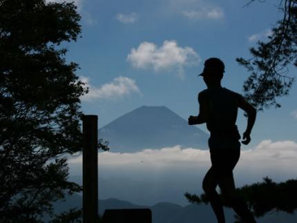
The Shibire Ryosen Trail Run is a 34-km course that starts and finishes at Yamanashi Chuo Bank Ichikawa Branch. The course has a steep ascent up to Mt. Hirugatake, and in the second half from Mt. Hirugatake to Mt. Sakuratoge, there are great views of the surrounding mountains, including Mt. Fuji, Mt. Ryugatake, the Yatsugatake Mountains, Mt. Kitadake, and the Minami Alps. One attractive feature of this course is the fact that it goes through almost all natural forests rather than artificial ones, so it is possible to run through a naturally formed forest tunnels consisting of many different types of trees.

![]()
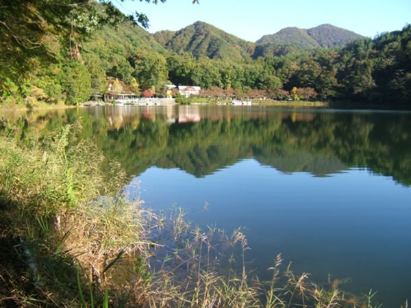
The course runs along the shore of the mysterious Lake Shibireko.

In the first half, the most difficult stretch is the part just before the peak of Mt. Hirugatake (in the section from Nishikatatoge Pass to the peak of Mt. Hirugatake), and you need to figure out how to avoid using up all your energy here. When ascending, make sure that your entire foot is contacting and pushing up off of the ground, rather than just the toes. Having a wide contact area lessens the strain on the legs and helps to prevent slips while climbing.
Course guide
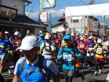
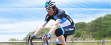
Start at Yamanashi Chuo Bank Ichikawa Branch. A paved road continues from here for a while. (Photo shows course during race.)
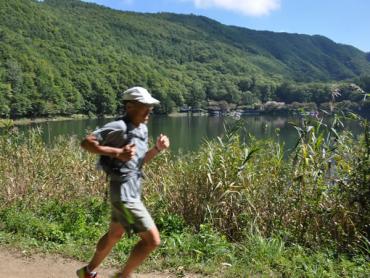
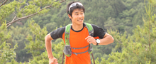
When you arrive at the mountain path, the course goes up a steep slope to Mt. Hirugatake (elevation 1,279 m). Along the way, the course runs along the shore of the mysterious Lake Shibireko (elevation 850 m). (Photo shows course during race.)
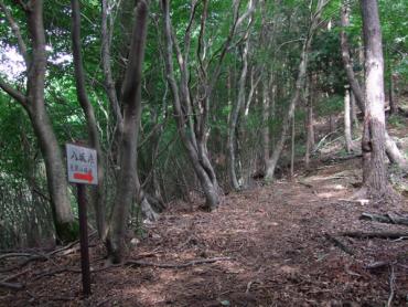
The path then goes from Mt. Hirugatake to Yasakatoge Pass, and this section is easy to run on. On the steep descent just before Yasakatoge Pass, proceed carefully in order to avoid putting to much strain on your knees.
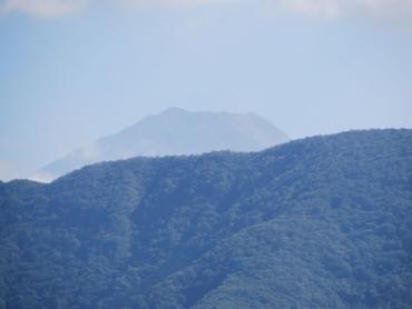
A paved path with a gentle downward slope continues for about 6 km, and the course returns to the trail toward Sakuratoge Pass. The view becomes nicely unobstructed at the peak and it is possible to look out at the Mt. Fuji and other mountains.
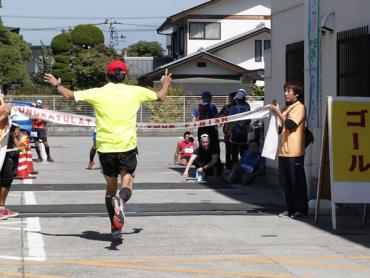
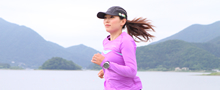
After the descent from Sakuratoge Pass, the course proceeds on a wide farm road. The course then goes into town and this is the finish line. (Photo shows course during race.)
Course information
| Difficulty level |
|
Elevation difference | 1,027m |
| Travel distance | 34km | Gradient |
Access
| Start | Yamanashi Chuo Bank Ichikawa Branch |
| Finish | Yamanashi Chuo Bank Ichikawa Branch |
| Access by car | From TokyoChuo Expressway Hachioji Interchange -> Chuo Expressway Kofu Minami Interchange, from here drive of about 20 minutesFrom NagoyaTomei Expressway Nagoya Interchange -> Chuo Expressway Komaki Junction -> Chuo Expressway Kofu Minami Interchange, from here drive of about 20 minutesTomei Expressway Nagoya Interchange -> Chuo Expressway Komaki Junction -> Chuo Expressway Futaba Junction -> Chubu-Odan Expressway Masuho Interchange, from here drive of about 10 minutes |
| Access by train | JR Minobu Line Ichikawahommachi Station, from here walk of about 5 minutes |
近隣のスポットを探す
Click the below icons to display the facilities on the map.
![]()
![]()
![]()
Some of the publications on this site are in PDF format. To view them, you will need to have Adobe Acrobat Reader. Please click the graphic link to download Adobe Acrobat Reader.