


HOME > CYCLING > Introduction of cycling courses > Tokyo 2020 Olympic Cycling Road Race Course
Main content starts here.

Tokyo 2020 Olympic Cycling Road Race Course

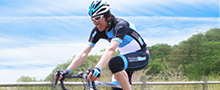
This course is intended for advanced cyclists. Selected as the (men's) course for the Tokyo 2020 Olympic Cycling Road Race, it crosses Tokyo, Kanagawa, Yamanashi and Shizuoka Prefectures. Here, we will introduce the details of the section of the course located in Yamanashi Prefecture.
51 km from the start* of the course in Musashinomori Park, it moves onto Doshi Road, and from there runs approximately 40 km, mainly in an upward climb, to Yamabushi Tunnel. As you go through Yamabushi Tunnel and come to Lake Yamanakako, the majestic Mt. Fuji is right before your eyes!
From urban areas to mountain village scenery and the spectacular views at the north foot of Mt. Fuji, you can enjoy the changes in the magnificent landscape.
*The first 10 km of the course from Musashinomori Park is part of the ceremonial parade route, so the actual starting point of the race will be Koremasa Bridge.
※Due to ongoing disaster recovery efforts, the section of the course from the Aoyama intersection in Sagamihara City's Midori Ward to the Yamanashi Prefectural border is not available for use at this time.

![]()
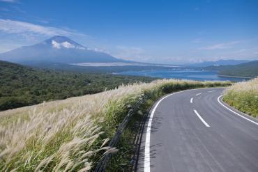
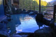
The course brings cyclists to Lake Yamanakako at the end of Yamabushi Pass, the most difficult point of Doshi Road with its lengthy, continuous ascent. The spectacular Mt. Fuji is visible from the northern side of the lake. There are even hot spring facilities along Doshi Road, so you can refresh your body and mind! You can take in the view of Mt. Fuji and Lake Yamanakako on the steep descent exceeding 20% from Mikuni Pass.

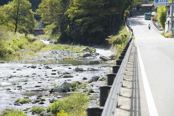
Doshi Road
The incline increases sharply as you approach Yamabushi Pass. Make sure not to run out of energy
on the first half of Doshi Road!
Kagosaka Pass
The course includes two laps through Kagosaka Pass. Since you will pass through during the last 20km of the second lap, check the course as you are going uphill and please watch your speed on the long descent down the hill.
Mikuni Pass
This 6.7 km section is not so long, but the average incline of 11.1% is extremely tough. There are even places in the ""doughnut section""(a section where the road surface is shaped like a doughnut) where it exceeds 20%. This is unquestionably a point that will determine which athletes win or lose during the actual race. When you arrive at the summit of Mikuni Pass, there will be extraordinary scenic spots featuring Mt. Fuji and lake views. Think of reaching these as you continue your upward climb.
Course guide
[Start] Musashinomori Park
The course begins in Musashinomori Park in Tokyo's Fuchu City, passes through Fuchu's Okunitama-jinja Shrine, and crosses the Tamagawa River via Koremasa Bridge. It then goes over the Minami-tama One Main Road, and moves onto Doshi Road.
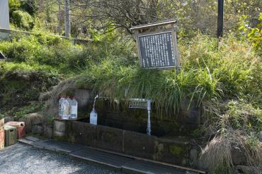
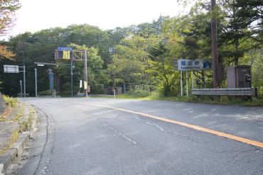
[1] Owata water collection spot
This is just past Ryogoku Bridge on the border between Kanagawa Prefecture and Yamanashi Prefecture. People come here with polystyrene tanks to collect the rushing water. Bike racks are available.
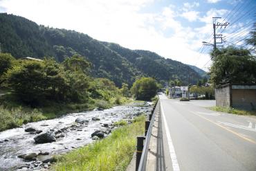
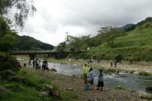
[2] Around Doshi Junior High School
You can cycle along the river here. This is a spot where you can take a moment to rest during the long continuous climb.
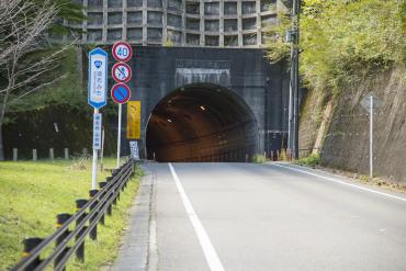
[3] Yamabushi Tunnel
This is the final difficult part of the moderately long Doshi Road.
[4] Hirano Intersection
The course turns right at Hirano Intersection and heads toward the northern shore of Lake Yamanakako.
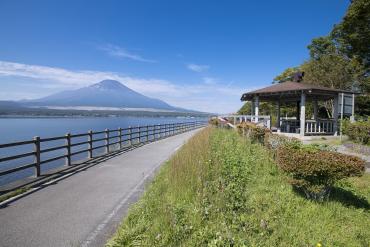
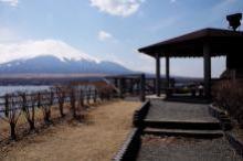
[5] View Point: Nagaike Shinsui Park
This is a superbly scenic spot with expansive lake views as far as the eye can see and Mt. Fuji straight ahead at the end of Doshi Road. Nagaike Shinsui Park is located alongside the cycling course, and bike racks and restrooms are available.
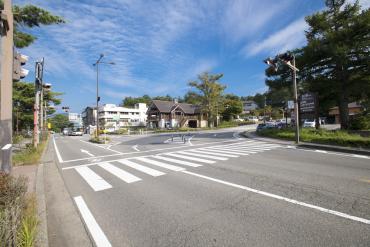
[6] Asahigaoka Intersection
The course turns right at Asahigaoka Intersection and heads towards Kagosaka Pass.
[7] Kagosaka Pass
The course then goes through Kagosaka Pass, and heads towards Gotemba City and Susono City. It climbs up the Minami-Fuji Evergreen Line and descends via National Route 152 "Mt. Fuji Skyline" at the base of Mt. Fuji. After going around Fuji International Speedway twice, it then heads towards the final difficult spot, Mikuni Pass.
※Because Minami-Fuji Evergreen Line is a toll road, riding bicycles is not permitted there.
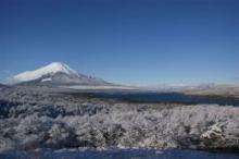
[8] View Point: Just past the summit of Mikuni Pass
The course enters Mikuni Pass from the Shizuoka Prefecture side, and there is a view point just past the summit.
A scenic spot where you can take in views of Mt. Fuji and Lake Yamanakako. This is a course with continuous hairpin curves, so be careful of your path and speed!
The course continues its descent and takes a left turn after the leaving the shore of Lake Yamanakako. It turns left at Asahigaoka Intersection and goes toward Kagosaka Pass.
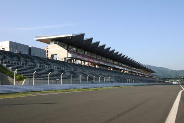
[Goal] Fuji International Speedway
This international circuit features the latest international racing course. You can see Mt. Fuji from the Shizuoka Prefecture side.
Color display on the Route map: Pink → Black → Blue
Course information
| Difficulty level |
|
Elevation difference | 1,451 m |
| Travel distance | Approximately 234 km | Gradient |
Access
| Start | Musashinomori Park |
| Finish | Fuji International Speedway |
| Access by train | 2 minutes by bicycle from Tama station, Seibu Tamagawa line |
Sightseeing spots in the area
Route map