


HOME > CYCLING > Introduction of cycling courses > The Lake Yamanakako and Yamanakako Panoramic Viewing Platform Course
Main content starts here.

The Lake Yamanakako and Yamanakako Panoramic Viewing Platform Course
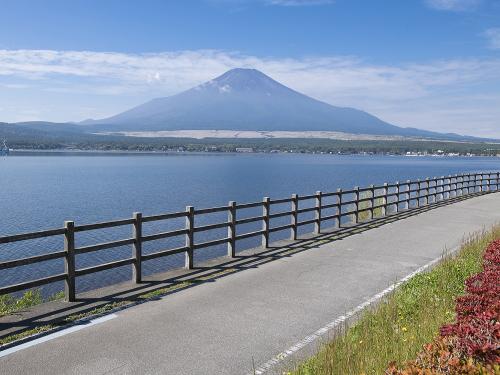
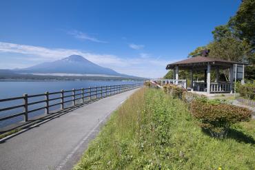
The Lake Yamanakoko and the Yamanakako Panoramic Viewing Platform Course goes around Lake Yamanakako, the closest of the Fuji Five Lakes to Mt. Fuji. The lakeshore features a cycling road, so you can ride comfortably. Please try taking on the hill climb to Mikuni Pass with an approximately 5% incline!
※You can also rent bicycles from rental cycle shops near Lake Yamanakako.

![]()
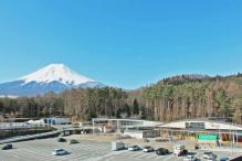
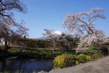
You can enjoy the Oshino district, famous for the remarkably clear, gushing waters of Oshino Hakkai Springs, along with beautiful sightseeing spots and water activities on the shore of Lake Yamanakako and the superb view of Mt. Fuji.
Don't turn around or look back during the uphill climb to Mikuni Pass. The superb view from the beautiful Yamanakako Panoramic Viewing Platform will be waiting for you as your reward!

Aside from Mikuni Pass, this course runs relatively smoothly without many ups or downs. However, Mikuni Pass has many tight corners and control is crucial when going downhill.
Course guide
[Start/Goal] Fujisan Parking Lot
The course exits Fujisan Parking Lot and follows the road on the right, then turns left at Megane Bridge and moves onto Route 139. It then follows the road on the left from Lake Yamanakako West Intersection and heads toward the shore of Lake Yamanakako.
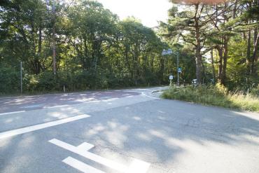
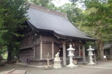
※The road is narrow around Kitaguchi Hongu Fuji Sengen-jinja Shrine, so please be careful when cycling here.
[1] Yui Plaza Hirari
The course continues with a view of Lake Yamanakako to the left. The course makes a right turn in the front of Yui Plaza Hirari and goes right at the Y-shaped intersection.
Returning from Mikuni Pass, it takes a left at the Y-shaped intersection (taking the road on the left). It then turns right at the T-shaped intersection. Yui Plaza Hirari has restrooms and bike racks.
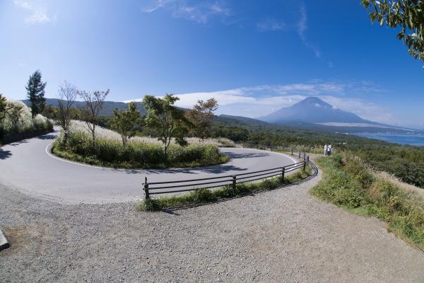
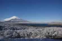
[2] View Point: Yamanakako Panoramic Viewing Platform
A superb spot for instagramming where you can view Mt. Fuji and Lake Yamanakako. Because of the continuous hairpin curves, be careful choosing your path! Mikuni Pass at the summit is the halfway point of the course.
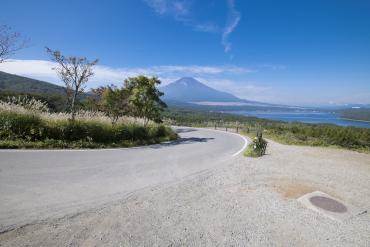
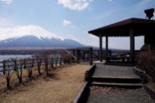
[3] View Point: Nagaike Shinsui Park
This is the second spectacular scene of this course, with the lake stretching out before your eyes and Mt. Fuji straight ahead. This scenic spot is located along the cycling course, and bike racks and restrooms are available.
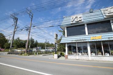
[4] Nagisa
The course turns right at "Nagisa," the building with the blue roof, and goes past the shore of Lake Yamanakako.

[5] Hana-no-miyako Park Ent. Intersection
The course turns right at the Hana-no-miyako Park Ent. Intersection and heads towards Yamanakako Hanano Miyako Park.
[6] Kamimura Intersection
The course turns left at Kamimura Intersection, then goes on the road and turns right at the T-shaped intersection.
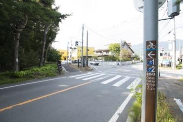
[7] Intersection in front of Oshino Hakkai Springs
The course follows the blue line and turns left. A shop called "Hakkaian" is on the right at the end of the bend.
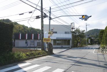
[8] T-shaped intersection on Route 138
The course turns right at the T-shaped intersection on Route 138.

[9] Fujimi Park Intersection
After turning left at the Fujimi Park Intersection, the course takes a right turn in front of Fuji Walking Park. Keep going this road, for a view of Fujisan Parking Lot on the right.
Course information
| Difficulty level |
|
Elevation difference | 324 m |
| Travel distance | 49 km | Gradient |
Access
| Start | Fujisan Parking Lot |
| Finish | Fujisan Parking Lot |
| Access by car |
From Tokyo: [When using the Chuo Expressway] Chuo Expressway Hachioji Interchange -> Chuo Expressway Kawaguchiko Interchange, from here drive of about 5 minutes [When using the Tomei Expressway] Tomei Expressway Tokyo Interchange -> Gotemba Interchange -> local road -> Higashifuji-goko Road Subashiri Interchange -> Fujiyoshida Interchange, visible from here From Nagoya: Tomei Expressway Nagoya Interchange -> Gotemba Interchange -> local road -> Higashifuji-goko Road Subashiri Interchange -> Fujiyoshida Interchange, visible from here From Shizuoka: Tomei Expressway Fuji Interchange or Shin-Tomei Expressway Shin-Fuji Interchange -> National Route 139, from here drive of about 1 hour and 30 minutes |
| Access by train | Fujikyuko Line Fujisan Station, from here bicycle ride of about 25 minutes on local road |
Sightseeing spots in the area

Route map